Tuesday, 29 March 2016

Walk Report - 'God and Water' - 28 mile Doncaster to Selby

A few posts back, I mentioned that we were considering the possibility of walking between Doncaster and Selby, and were looking at a modification to a cycle route.

So, come Monday, I hauled myself out of bed at the stupid time of 04:15, consoled only by the knowledge that Bob had had to get up even earlier, and after a cup of coffee, started finalising my kit for a days walking! Outside, it was absolutely pissing it down, and had been for hours.

Ready and waiting for 05:00, it was another half hour before Bob arrived, having had to drive slowly to avoid flash flooding in the dark! We loaded my kit into Bobs car, and left for the drive to Bobs workplace in Doncaster town center. It was quite obvious that this was not going to be the most pleasant walking weather!

Around 06:30 we were sat in Bobs office, nattering with one of his colleagues, who despite stating that we were nutters, made us a nice brew. We checked the GPS units had the routes in properly, distributed the food between us, and at about 07:00 or so set out for the short walk to the official start of our new route - St. Georges church, now it seems also known as Doncaster Minster.


Nice and cheerful at this point, despite being already rather moist. Bob laid hands upon the stone and said his benedictions to his god, and we set off!


Going wrong immediately! It seems theres no gate at the corner of the churchyard, so we came back to the gate we went in by, only to find that its a four foot jump down at that point! Not something to do when you have a 15kg pack on your back in the pouring rain! So, we again went back to the church door, and out along the proper path. From here its a simple skirt around a big shop and up a spiral staircase onto the old North Bridge. At least, it would have been, if contractors hadnt closed it off! A short diversion led us in completely the wrong direction for a few hundred yards to the other steps, and then we were finally heading over the bridge and out of town


From North Bridge the route goes down to Yarborough Terrace at the top end of Bentley, over a big footbridge that crosses the very busy intersection of the new North Bridge, before crossing playing fields and then two railway crossings, one a low bridge the other an unmarked level crossing, and out onto the river Don flood banks. On a wall behind the estate here is what looks like a Banksy, whether its a genuine one or another artists work I dont know, but its very good.


A quick stop for a selfie before we struck out along the top of the bank towards the old Pilkingtons workings at Fox Covert and Thorpe Marsh


Already, it was proving difficult to keep the phone dry!


Approaching the workings, things started to get a bit wetter underfoot. At least this time we had managed to be on the correct side of a series of ponds and so didnt have to cross a muddy ploughed field like we did at this point on the Doncastrian, but the path through Fox Covert was quite flooded and needed a bit of care


The old timber bridgework that carried the slurry from the float glass process at the Pilkington Kirk Sandal plant on the other side of the river and canal to the settling ponds is in amazing condition for a relic of close to a hundred years of glassmaking! Once beyond this, we had the short stretch of road into the edge of Barnby Dun to cover. This is one of the unpleasant parts of the walk, as its a fast road, lots of bends and two bridges, and no footpaths. This brought us to the Barnby Dun lifting bridge on the South Yorkshire Navigation. Here we joined the towpath towards Kirk Bramwith


Shortly before you reach Bramwith Lock, the canal splits, the left side heading over an aquaduct that crosses the river Don, to form the New Junction Canal to the Aire and Calder Navigation. We would rejoin this in a while for much of its length. Incidentally, I would advise not venturing too far off the path around here, as Bob in the absence of man-made sanitary ware was forced to attend to his daily constitutional au naturel (the annual memorial service for the fallen socks will this year also commemorate gloves lost in combat during Bobs endless battle with his digestion). At Bramwith lock we crossed over the lock gates and joined the road into Kirk Bramwith


Kirk Bramwith is a very small village with a lovely old church, where a Snowdrop festival is held each year in early spring. From here it was a short section of road walking to Braithwaite and the Top Lane lifting bridge to rejoin the New Junction canal towpath and the Trans-Pennine Trail. The rain by this time was at least easing off, but it was still rather wet


We were keeping well hydrated, possibly through absorption,  and I was averaging 2.5mpp (miles per piss), with Bob much the same.


Approaching Sykehouse, we again crossed the canal at the lock, pausing for a while to watch as a narrowboat piloted by a bloke almost buried in a so'wester, passed into the lock. There is something very pleasing about canals, and locks in particular.


By now we were coming up to about the half way mark, so started looking for a suitable place to stop and change socks, not an easy task in the weather conditions! In the end, we found a bus shelter just outside Sykehouse, and with the next bus due a few days later, settled down for a good sorting of feet and some lunch.

My very careful attention to my right heel was working well, and my feet were in very good condition. Bob was finding things a bit tougher, having made a poor choice of boot for the conditions. I started my lunch with a chocolate noughat bar that took more calories to chew than it contained


Heading now, feet refreshed and bellies refueled,  toward the village of Topham and then on toward the crossing of the Aire and Calder canal, we passed a converted windmill before crossing the river Went. Shortly after we had to pass under a high voltage power line, where we noticed a very bad wind oscillation on the cables of the lower tier. The photo below is in fact just to remind me to report it to National Grid!


We were now approaching Pollington, and crossed the Aire and Calder canal. By now the rain had mostly stopped, and we were beginning to dry out. Bobs fear of having suffered a stroke proved unfounded when it was realised that he just couldnt feel one side of his face from the windchill, and I was still suffering the bizarre one dry/one wet hand, due to being constantly battered by the wind and rain on my left side.


From the Aire and Calder it was back to road walking, a mile or two, during which time we again had to find somewhere for an impromptu refreshment break, and we were climbing the bridge up and over the M62


I took the opportunity,  which rarely presents itself, to do a spot of dad dancing on the bridge, much to the amusement of several passing drivers


So, we were now ready for another sock change break, and had planned this to be in the churchyard at Snaith Priory. But, Bob being Bob, the desire for porcelain plumbing led us into a nearby pub.


So we took the time to enjoy a cold drink (non alcoholic!) and relax for a while, whilst giving the old tootsies a fresh load of tape and padding. Bob enjoyed inspecting his blisters, which by now were quite a bumper crop, and decided that the weather was actually quite nice now, so we would pack away the waterproofs.


It was, however, still a bit chilly to do without the woolly hat!


From Snaith, there were just a half dozen miles to go! Our marker for the distance was to be Eggborough power station, which loomed on the horizon. From Snaith the road took us out over the river Aire into Carlton, where we realised a few hundred feet could be shaved off the distance by taking a side road, and then we struck out onto the long road section to Hirst Courtney and its many commercial greenhouses. By now our feet were starting to get a bit sore. My dodgy toe was intermittently giving me a lot of grief, its sharp and sudden intense pain making me wince, but was relieved for quite a while by any short rest stop, such as the one I took behind a tree just short of Temple Hirst!


By now we had adjusted the data fields indicated on the GPS units to show remaining distance. This proved to be a good moral boost. The weather was better, still windy but now on odd occasions even warm enough to remove the hat for a while!


But shortly after leaving Hirst Courtney to head on to Burn, the weather decided we'd had quite enough pleasant walking, and the rain started again. We held out for a while then stopped and put our waterproofs back on. The rain stopped about ten seconds later! But, it would prove to be intermittent from now on, so we kept on as was.

Reaching the level crossing at Burn shortly after a train had passed, I decided I needed to rest the toe for a little while. So as we started around the peritrack of the old RAF Burn airfield, we looked for a place to stop. A small mound of rubble suited this purpose, and we rested for a few minutes and shared a bottle of Lucozade. We were nearly there, over twenty miles done, and in great spirit. We were starting to tire, the legs beginning to ache, and the feet a bit sore, but remarkably better than usual for the distance, and in spite of the weather. The airfield was skirted with much discussion on the fields history. It was nice for me to be walking a familiar section but which Bob was new to.


Our route off of the airfield though did look somewhat tricky as we approached -


Luckily, this expanse of water was only a few inches deep, and we were soon around it and ambling up the side of the railway to the underpass below the A63 bypass, where we got our first glimpse of the Selby canal and the familiar route of our old stamping ground of the Selby Horseshoe. As we crossed Brayton bridge to gain the towpath, the GPS units indicated a trifling 1.5 mile remaining! I had already sent a text to my good lady requesting our taxi for 18:00 outside the Abbey! But, at this point for me personally, a more pressing priority seemed to be the possibility of having to repeat Bobs earlier actions beside the South Yorkshire Navigation! Talk turned to whether or not the Abbey would still be open to use the visitor facilities!


 The familiar sight of the chemical works and the shops appeared, closely followed by the Selby Boat Center and its collection of vessels. The bridge ahead would lead us off the canal towpath and onto the direct road to the Abbey


With a mere quarter of a mile to go we started up the railway bridge and passed the official sign for the town. Our feet now realised we were nearly there and decided they had already finished, so began to complain of having to keep going! But it was such a short little distance to go, and even the temptation of the odours wafting from the Jinnah curry house didnt divert us


As it happened, the Abbey was closed. But the main gate was open so we completed the walk as we had started, some 11h earlier, by touching the stone.


We then, having come some 27.7 miles, settled onto one of the benches to await recovery by my wife, who was delayed by the level crossing and Network Rails amazing ability to schedule four trains across it at the same time. During our brief wait, we met a chap somewhat worse for a few bevvies, and seemingly undecided whether to be sad at some perceived sporting failure, or to continue singing joyous hymns, and as if it knew we were now sat, immobile, wet and cold, it began to absolutely piss it down again.


About ten minutes later, we were collected by my wife, with my son, and in my car, and driven home. A brew and a snack, and for me a change of clothes and a visit to the lavatory, and all that remained was for me to drive back to Doncaster, drop Bob off, collect my trainers and flask from his car, visit my mum, and drive back home to Selby for a nice hot bath. Stopping just the once in Eggborough to relieve the cramp in my leg!

27.7 miles, 11 hours. And now we have seen a few places we can shave a mile or two off. Bob has published the route as a Garmin Adventure for others to try, and were considering doing it again, but adding the York Lines route and taking it all the way to York Minster, after all, its only another 16 miles...


Wednesday, 16 March 2016

Lions Summer Walk 26th June

Having a father in law whos heavily involved in charity work means by default so am I. One of the things I do for the Lions is to maintain a fleet of 2-way radios, which are used at various events.

This year the Lions are hosting a charity walk between Doncaster and Thorne, in aid of a Doncaster Royal Infirmary scanner appeal. This is a bit under 12 mile I think.

Well, we have our entry submitted and our numbers. Me and Bob will do this one operating the radios as we go, and so im also now in discussion with the regulator Ofcom for a special event radio license. The plan being to set off at the front of the walkers, along with the van of the walk, which includes Ben Parkinson, and I believe Doncaster Rovers. After a while we will slow and drop back, allowing others to pass us, before moving up again, essentially just moving about amongst the walkers, keeping an eye on them and helping out anyone who needs it.

More info here http://www.thornerurallions.org.uk/doncaster-cancer-detection-trust-charity-walk/

As I understand it a Just Giving page or similar will be established at some point, for you all to sponsor us via.

This walk will come less than a week after our next crossing of the Lyke Wake! So watch out for the two muppets with radios walking like John Waynes stunt doubles!

Recovery from mondays Doncaster Monster is coming on nice and swiftly. I can just about walk at normal pace again! Still a bit of aching and a pain in left thigh above the knee. The only real trouble is that now my heel has begun to heal, its tightened up and become fairly painful when walking due to the pull on it as I step. So no running in the gym tonight, but a bit of bag work and some rowing are perhaps in order.

Tuesday, 15 March 2016

Proposed New Walk - Doncaster to Selby 27 miler - The 'god and water' path

With me living in Selby, and Bob in Doncaster, we've been looking at possible routes between the two towns.

Bob found a cycle route, but it wasnt quite to our liking, so ive adjusted it somewhat. Although I will not publish the actual route until we've walked it ourselves and proven it, I will reveal a few details here in advance,

The route is a 27 mile walk, between The Abbey in Selby, and St. Georges church in Doncaster (some are now calling this Doncaster Minster!). It uses some sections pinched from other walks, such as the Bentley to Barnby Dun riverside stretch from the Doncastrian Way, and the Burn to Selby canal path from the Selby Horseshoe. As much as possible is along canal towpaths. It takes in several churches, quite a few swing bridges, and even a Second World War airfield!

Hence the provisional name - God and Water

Despite being 27 miles, its mostly flat and easy going, the only energetic bits being some stairs in Doncaster! Doable in a day as a single walk, or can be easily split into three smaller stages each with good 'escape routes'

Roughly -
Doncaster - Barnby Dun - 6 miles
Barnby Dun - Snaith -       10.5 miles
Snaith - Selby -                  10.5 miles

Food and drink, either shop or pub, is just off route in Barnby Dun, by no more than a mile.
Plenty of shops and pubs in Snaith.
And a smattering in other villages.


Bobs going to check out his end of the route over the next few days. I'll do the same my end.
And then, we'll walk it!

Doncastrian Way - 14th March 2016

Being a native of Doncaster, i'd known of this long distance challenge since I was quite young, probably 12 or so. Im not sure where I first found out about it, perhaps when I was in the scouts. I sort of knew of it passing through the next village from mine.

Anyway, it had long been on my list of routes to do sometime. So, when me and Bob were looking for something long and a bit different to the usual fare of doing the three peaks again, I suggested we took this one on. Bob of course was all over it like a rash!

Normally for a route of this length there would be several weeks of planning... nah, sod that. We decided to knock this one off the next day we had off work together. However, we did decide to do the fluids, nutrition and sock change regimen as a dry run for the next Lyke Wake.

So Bob planned the meals, I informed my mum that we would be taking over her driveway at 06:00 on monday morning (I told her this 11:00 saturday!), Bob treated himself to a new GPS unit, and I obtained a copy of the 'official' route from the Vermuyden branch of the LDWA. Parking at my mums meant a couple or four extra miles between villages to get on and off the actual route.

Well, yesterday morning arrived, and after a pretty poor attempt at a nights sleep, I slipped out of bed at 04:30, put my trousers on, had a cup of tea, made up a flask and loaded the car. At 05:00 I set off for the drive to my mums, and a text to Bob woke him up.

A bit of breakfast, some tape on the feet, and a mug of steaming brown liquid (potentially decaf coffee) from the flask, and a chat with my mum, and with every electronic device about our persons set to record our progress, the above pictured duo of metalists hit the trail


In very little time, what to us as kids had seemed a very long walk to the next village, was done, and we reached the farm shop, our rendevous with the official route. We were already two miles in! From there over the canal and river to cut left into Fox Covert and down past the 1900s remains of 'the second st. Helens', this being how Kirk Sandals Pilkington float glass plant used to be known. It was rather muddy along this section


But we were soon out of that and onto the flood embankment towards Bentley. A small miscalculation here but soon corrected and back on course, with slightly heavier boots due to claggy mud. At this point we realised that there would be a few styles along this walk - we dont mind styles when walking light, but are not so keen when we have a 15kg pack each!
But we went on, the countryside starting to wake up around us. Soon the double railway crossing into Yarborough Terrace was behind us, and after threading our way around the early morning chavs and crackheads, we were over the roundabouts and passing back into open country with HMP Doncatraz and Crimpsal MF station on our left, Cusworth hall on the horizon to our right,


Pressing on, we approached Sprotborough Falls, Bob as usual on the hunt for some plumbing facilities. What we found, whilst interesting, were not quite the comfortable sit-down porcelain Bob was favouring


Over the falls, up the bends, and away across Warmsworth we went, noting with interest that the big pub is now a resturant, just as well really since I was barred from there some years ago (not for the obvious! - I put a cue through the pool table lights during a bad shot), past the sewage works and over to Alverly Grange, passing the very house my wife grew up in, and the fields where she used to horse ride


The woods between here and Wadworth were a sea of thick, cloying mud, churned up by bikes. Somewhere along here I took a nice whippy sapling right across the lip! Ooh that stung a bit! The picture above I dont think is from this stretch of the walk, but I cant be bothered getting them all in proper order! The ones below however, are as we crossed the final fields to Wadworth and our lunch stop!


In the very far distance on the photo above, it was possible to see the tower of Rockware glass factory. We had started several miles on the other side of it! It was quite amazing to think that we were now right over the other side of town from where we started!

 We stopped for lunch and sock changing in the churchyard. Coconut water and pasta, and fresh socks! Feet not too bad at this stage. Feeling good al round. As expected my right heel was blistered, so that was Compeeded up, but my left ball of foot and toes were doing better than expected.


 From Wadworth a steady bimble, with a bit of a play on 2m FM, led us down into Rossington. Here the GPS track showed differently to the available footpaths, so we decided to go with the GPS and ploughed on straight over the pit top! We passed round two of chav and scum, stopped briefly at the level crossing, which we went over in the half a dozen seconds that it opened for before the next train, on into the more affluent part of the village (taking me away from the temptation of a kebab special at the Nelson chippy) and off over the open parkland leading eventually to Bawtry Road and the Mount Pleasant Hotel


 The above photo taken I think in Kings Wood, was taken during one of around half a million momentary 'refreshment' breaks! We do like to keep properly hydrated...


Starting to ache a bit now and with the feet becoming a little sore, we passed the lakes and made a slight navigation error requiring a bit of inventive navigation, a minute or two of death defying climbing on a narrow ledge under a bridge, and the customary few hundred yards run, to regain the railway crossing we should have used at this point. But we didnt die, again, and so carried on, passing within calling distance of Bobs mums house, and over to our second foot care stop at Auckley, the time now being about 15:00


Socks changed and bodies refueled, we set off along the pleasent banks of the river Torne, for the long stretch to Hatfield Woodhouse. This also involved the hairy scary walk along the side of the rather fast road, but we were soon off of this and a brief stop at a farm allowed Bob to replenish one of his water bottles from a farmers hosepipe! It was now just gone 16:00, it was finally T-shirt weather, although this wouldnt last much longer


As we made our now slightly weary way along towards the crossing of the M18 besides Ruane Potatoes, the sun finally set and the light began to fade. We were still around ten miles from the end. These last few photos from the walk show the dying embers of  the day


Now, footsore, tired, aching, we pushed on towards Dunsville. Neither of us quite sure which way the route took us here. As we bent our weary way past the spud factory, a waxing moon stood above us in the now forbidding darkness. Crossing open fields again, we realised that a couple of head torches wouldnt have gone amiss. But, soon enough we reached the bright lights of Dunsville. We now knew all that was in front of us was to cross the fields to the edge of 'Ratties Wood' past the old ICI bunkers.

That said, we didnt remember that theres a wood to go through first! By now it was very dark, the stars were beginning to shine over us, as we threaded our way by the light of Bobs I-phone. The woods past, we could see the bright lights of the driving range to our half-left, but the glow of a passing train showed we were a good way yet from the final level crossing. By now we were moaning, breathing heavily, but still in surprisingly good spirits and maintaining a decent enough clip.

The next train to pass showed we were close, and then we were back in civilisation, or as close an equivalent as posisble on Pinehall road in Barnby Dun! Back on home ground, it was just a 'short' walk from here, over the railway bridge, and across the fields back to my mums house, pausing only to send her a text telling her to get a brew on!

And then, we were done! Sat with stinging feet and slowly seizing limbs at my mums kitchen table, agreeding whole heartedly with her assesment - 'your bloody mad you two'

13 and a half hours, 35.4 miles. We had done it. Back in time for tea and medals!


Compeeds are great until the come off early!


Monday, 7 March 2016

Blog Rename

I have renamed this blog, since the original title 'MAG Lyke Wake Walk 2015' no longer fulfills the needs of the content.

Last year, myself and Bob completed the Lyke Wake Walk on behalf of the landmine and UXO clearance charity MAG. This year - were doing the walk again - backwards!

But also, we will be doing other Long Distance and Endurance challenges - The Yorkshire Three Peaks (an old standby), The Doncastrian Way, and the Lions Mid Summer Walk, to name a few.

So this blog has been renamed in order to encompass all this.

Wednesday, 1 July 2015

The Horror! The Horror!

If your considering doing the Lyke Wake Walk, and our previous report hasnt put you off, then perhaps this one will!

This post is a collection of photos that form part of our BDA - Body Damage Assessment!

On the whole, pre-preparing our feet saved a lot of hurt. My bad heel is mostly due to a Compeed failing to adhere properly and me not realising until too late. Pre-treating with Compeed any areas that you know from experience might blister is a very good idea, as is overtaping the Compeeds with micropore or other suitable tape. My left heel, which didnt slip, suffered just one small and barely noticeable little blister.

The toes are harder to plan for, and the damage here is mostly late on

Bob -


Martin -


Tuesday, 30 June 2015

Post Walk Report

Lyke Wake Walk - Crossing Report
28th June 2015
Unsupported
Walkers - Martin Barfield, Robert Hooks
Sponsored, on behalf of MAG International

It had been on my mind to do something for charity this year, and as I like to have a decent level of challenge when asking people for money, I was looking for  something a little on the tough side.
It had long been a dream of mine to take on the Lyke Wake Walk, my wife informs me i've been mentioning it on and off for about a decade! So the plan formed to do the Lyke Wake to raise money for the charity I support, the Mines Advisory Group.

Several months of planning and training followed. First, I coerced an old mate, Bob, into joining me. Although five years my junior, me and Bob as teenagers were like brothers, and anything we did together always became an adventure, and frequently a disaster! No longer teenagers - im coming up on my fortieth next year! - we began training to get into some sort of acceptable shape. Bob has always been far fitter than me, so he helped me along, even getting me out running for the first time in 20 years, albeit at a fairly steady jog, and we got out on 10-15mile hikes, culminating in taking on the Yorkshire Three Peaks twice in the space of nine days, and only nearly dying on the second in abysmal weather.

Bob works with vulnerable adults and on security, whilst im in broadcasting, but we have both been radio hams since our teens. So, we decided to add a little more to the challenge - and try and make radio contacts as we went. Initially we planned using a shortwave radio for this, and borrowed an ex-army man-pack radio. We started taking this up the Pennines for practice, whilst I also persuaded the government regulator Ofcom to issue us with a Special Event License. This was tricky, as one of the rules clearly states that any such station must be in one place, no mobile operation is allowed! After a lot of negotiation, and assuring them we could meet some very stringent rules, they let us have a license for just one day, and a special radio callsign of GB0MAG. By this time however, we had realised that if we attempted to do the walk with the manpack radio, we'd probably be dead by the time we got to Fat Betty!

Back to the drawing board for the radio, but in the meantime our fundraising took a good turn, when my employer, Arqiva, granted me a voucher to auction on ebay, allowing two people to take a trip up the famous Emley Moor TV Tower. I also arranged a trip up the tower for myself (Its where I work) and Bob, and a young lady called Hanna - our co-ordinator from MAG, to take some promotional photos of us in our charity T-shirts. The tower trip auction raised around £250.

By now we had revised the radio plan to a small VHF hand-held radio and a back-pack mounted antenna, arranged all the kit we thought we'd need, worked out how much water we had to carry, and pestered everybody we knew, and many we didnt, for sponsorship. I had posters all over the offices, Bob blocked the door on one of the clubs he does security for and wouldnt let anyone in until they had signed a sponsor form!

It was always our intention to be unsupported - mostly since we had no one free to provide support! So we knew our packs would be heavy. But we also appreciated that much of the weight was water and food, and so they would get lighter as we went further. We'd studied the route elevation profile in detail against that of the three peaks we'd already conquered. Alright so it was 15 mile longer, but it looked much more gentle - how wrong were we to be!

And so, the day finally arrived. Bob arrived at my place around 13:00 on saturday 27th June, so we had time to finalise who was carrying what kit, check the maps etc, and refresh ourselves on our 'actions-on' - neither of us are in peak condition, Bob has a heart condition and a bad knee, whilst I have bad knees and shoulders. Between us we just about have a complete working body. At about five in the afternoon we set off for the convoy drive to Ravenscar. When we arrived and parked up, it was glorious sunshine and the sea was shimmering below us. We decided we would finish at the sea and go to sleep on the beach! At this stage we hadnt any idea that this was not to be.

Leaving Bobs car at Ravenscar (a decision based on Bobs comment - "Im not trusting you to drive us back with your knees") we took ourselves over to Osmotherly in mine, stopping first in the village to partake of fish and chips and a non-alcoholic beverage in the Golden Lion. Nicely full, we drove up to the car park at the reservoir, and started getting ourselves prepared. It seems the car park is quite popular 'after hours' and we started to get a little concerned over the wisdom of leaving the car there overnight, it seems its used a lot by the local youth for the sorts of things local youths like to do away from other people! Soon we had our feet prepared with ample quantities of Compeed blister plasters and sports tape, and the contents of a flask of coffee in us.


It had been our intention to start walking at 01:00 on sunday morning, but by 11pm we were ready, and being eaten alive by midges. We took the decision that despite both of us having been awake since around 07:00, we would forgo the chance for a couple of hours kip and crack on. So we made sure everything was out of sight in the car, locked up, and heaved our shockingly heavy packs up onto our backs. Firing up head-torches and the GPS, we strode out for the first leg into the woods.


Somehow, we actually failed to see the marker stone at the start, so took our first photos at the next one we found in the woods. At this stage all was very pleasant and reasonably easy going, although the sky was overcast making the woodland paths very dark. As things began to get a little more strenuous, we were glad of the darkness - It meant we couldnt see what we were in for! Soon we were out in the open, the last glow of the setting sun behind us, the twinkling lights of civilisation, or at least Teeside, away to our left, and a gibbous reddish moon high off to our right, as we found ourselves taking on the first of the steep inclines towards the summits.

Before we knew it, we were up and over the two summits of Drake Howe and Round Hill, Heading for Bloworth Crossing and the easy path of the Farndale railway, having passed several examples of late night moorland activity -notably poaching and courting! The sky black behind and above us, with just a bare handful of bright stars visible through the high cloud, but the glow of dawn before us. We were feeling good, our feet were in a reasonable state for the distance covered, and anyway we were close to our first official stop and sock change!. This was meant to have been at ten miles in, but we decided to drive on to 15, and see how we felt then.

By the time we hit the railway trackbed, it was around four in the morning and broad daylight. We'd decided in advance to take the newly re-opened section of path to Flat Howe in order not only to cut a bit of distance off, but also to remove any temptation to visit the Lion Inn, which having walked this section a few weeks before to see how the new path was, I knew would be a fatal move to enter. All of which was now rather academic since at the time we would be passing the pub wouldnt be open yet! I set the GPS to find the start of the path, and we eased our way down the railway path.

It was here that we started to experience what would become a constant feature of this walk - the time dilation! It seemed that no matter how long we were on this path, the turning never got any closer! We would go around several bends in the path, and a glance at the GPS still showed the same distance to go! But, by now the landscape was awakening. We contented ourselves with discussions about the livestock and wildlife, the history and technology of the railways and musings on what it must have been like to work the ancient industries up on these moors. And soon the start of the 'detour' was upon us, and we struck out east, and into the first of the bogs.

Despite his sudden horror at finding himself crossing boggy ground at this stage, I assured Bob that it only lasted a few hundred meters and then the path became easier. He wasnt at all convinced, but soon we were sliding past white tipped boundary stones and heading for our first rest stop.

Reaching the road and the standing stone at Flat Howe, we stopped to check and repair our feet, which by now were giving vague hints at being a little weary, such as the balls of the feet stinging and the toes aching, and to have breakfast. Feet first. Reasonably good condition, i'd had a blister plaster slip and so had a nasty sore spot on one heel, soon treated, but otherwise just swelling a bit from sweat. Fresh socks and they felt lovely again. Breakfast consisted of the contents of our 'growler bags' - pork pies, scotch eggs and a pastie. It was at this point that our appetites utterly deserted us, and we dolefully forced down what we could. We began to realise we might have slightly overdone it on the catering front - as well as the growler bags, we had enough food to feed a small army - ironic as our food was army issue ration packs! It was at this point that reference to Bobs iPhone, which was running a fitness app tracking our progress, made a dent in our morale. We thought this was midway - the app told us we'd done only 17miles.


Refreshed and fed, we struck out again, only managing to go a few yards down the wrong path before correcting our error, and heading for Rosedale Head and Fat Betty. Here was to be our next photo opportunity, as my neighbour Mick had insisted we must visit this cross. As we walked, Bob spotted a small blue van in the distance with an antenna on the roof, also heading towards the cross. We had jokingly put on our various webpages about the radio side of things that should anyone wish to see us, they could do so at the various road crossings - if they brought hot drinks! As we closed in, we found ourselves met by the smiling presence of Graham, a fellow radio ham, and at 80 years old a veteran of the Lyke Wake Walk (28 crossings, fastest East to West 14h). From his little campervan he served us up hot sweet tea, and provided a very unexpected but welcome boost to our morale. It was around seven in the morning, and he'd driven from Scarborough to meet us. We hadnt even set up the radio yet, that was planned for 08:00. We were so amazed that this spritely old chap had taken such trouble to come and see us. We got our photos, gave our thanks to Graham with many firm handshakes, during which he even generously slipped us a tenner for our charity, and set off again on the metalled road section, stopping to use one of our back-up radios to provide Graham with the radio contact he'd come for, our first of the day, and as it would turn out later - the only one!

A little before the turn back onto the moorland path and the expected bog around West Gill Head, we stopped and rigged up the radio. The backpack antenna, mounted on a thin fibreglass mast, sticking high above my pack. We started making our first calls on the radio, but it was still very early and we didnt expect much response at that time. We began to find ourselves picking our way across the bogs, jumping from tuft to tuft, stone to stone, and frequently stopping to survey the ground and decide on the best course, avoiding the frogs. Luckily, the recent weather had been quite dry, and although there were many deep and oozing sections of stinking bog, these rarely managed to creep above the ankles. We both decided that our decision to use gaiters that day was a wise move. But on the whole, the path over the peat was springy, like walking on a trampoline, and kind to the feet. We headed on for Shunner Howe.


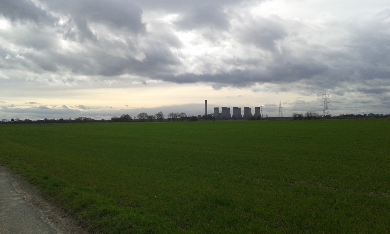
Our morale had been dented at 17 miles, now, at about 22 miles, general fatigue started to turn to pain. Having passed the bogs, we found ourselves heading to the Blue Man i' th' Moss, and yet another time dilation. With the woods off to our left, and the occasional glimpse of the PAVE-PAWs building at RAF Fylingdales a shimmering pyramid on the horizon, we found that the woods seemed never to move, and the path just seemed to go on forever. We renewed our efforts with the radio to no avail. We realised that despite being the highest points on the hills, we were surrounded by more hills that cut us off from anyone else with a radio! We couldnt even reach any of the various automatic repeater stations located in the surrounding towns, and our cheap 'radio on a chip' type back up radios were rendered useless by the pulses emanating from the still distant radar station. I had also convinced myself that we had to cross the North Yorks Moors Railway line somewhere soon, and was dismayed that I couldnt see it.


We slogged on. Feet now hurting. Shoulders aching. Backs aching. Our usual banter and ready wit, much of it harshly derogatory about each other, had long since deserted us, our minds, mine at any rate, filled instead with the phenomena of the 'crap tune' - in my case the 1980s blockbuster classic 'Pump Up The Jam' which played annoyingly in my head on an endless loop. Conversation between us was limited to comments of the 'Can you see...' or 'where the heck is' type, along with 'mind that...' and 'I hate this..' (insert expletive and terrain type). The path now turned to uneven and jagged rocks. At this point, we decided to abandon the radio operation, mostly because the antenna snapped! Perhaps it was damaged by catching the low hanging branches during the night. We attempted to repair it, but the result was at serious risk of having one of Bobs eyes out! I told him to rip the thing off my pack, and we packed the radio away. The damaged antenna stashed under the heather and a GPS fix taken for later retrieval.

We had long ago discovered that, for us, there is a holy trinity of walking aids - Compeed plasters, Trekking poles, and rehydration powders. We were both silently thanking the manufacturers of these by now, but the paths were so narrow and the heather so thick that the poles made little purchase and failed to give us the forward push we needed from them. And the moor went on, and on...

After what seemed a lifetime, we saw a road. There were three cyclists stopped at a gate - other people!  But they had gone by the time we got there. We pushed on toward where the GPS told us the Roman Road was. By the time we hit it, a location that in ordinary circumstances would have led to much interesting discussion on the Romans and their engineering skills, the simple comment of 'Roman road that' followed by a lone 'Yep', and we were over it and staring in disbelief at the drop into Wheeldale Beck and the stepping stones. It was here that our relative fitness levels began to show their difference. I find the steep sections hard going. Bob, being much fitter than me, doesnt find them quite so hard, which means he frequently stops for me to catch up, which of course means he gets a bit of a rest! Taking the steps up the other side a few at a time, I found that even though my muscles were still willing, and my body thrilling with energy from the Dextrose tablets I was eating, I simply couldnt take in the oxygen fast enough! I was also by this time eating Ibuprofen like sweets. It was something of a let down to reach the top and realise that the next section to Simon Howe was also uphill!


It was here, on the path across Howl Moor, that we met our first and only fellow traveller on these paths, a young fell runner coming the other way. He stopped for a minute or two for a chat with us, where we learnt that he is doing the Lyke Wake in a few weeks time, but was only running as far as Blakey today. We traded a few horror stories. But the best thing he said was his opening comment to us - 'Ive just passed your support driver!', so, Graham had kept his promise to meet us on the Fylingdales road! This was a terrific boost to our flagging spirits and we resolved to really put a spurt on to reach him. We realised as  well, that whether we pushed ourselves to go as fast as possible, or slogged along slowly, we would be in agony either way. It might hurt more to go fast - but it would hurt for less time. And for the first time in this walk, we managed to crack sub-20minute miles.

But it took its toll. By the time we finally reached the railway, we were seriously flagging. The short section from the railway track to the road left me about 50yd behind Bob, but there was the wonderful sight of Grahams little blue van! And despite being somewhat behind, I had my first laugh for some time when I saw Graham point up the road to the carpark, where there was a vehicle with a red stripe, and heard him say 'theres an ice cream van, and a mountain rescue team - which do you want?', at that point, my feeling was either or!

With another very welcome mug of steaming tea in hand, we took the time to rest and change socks again. To my amazement, much of the trouble with my feet was still just swelling from the sweat. However, actually bending legs to change socks was a slow and arduous process! Several times progress stopped to allow cramp to pass. We filled the time chatting with Graham about walking, radio and heart conditions. Once again we thanked him profusely with a round of handshakes, and set off pleased to have met with such a fine fellow. We had around ten miles to go. More behind us than left in front, and with the ominous obelisk of RAF Fylingdales to our right, we set off for Eller Beck.

We took the opportunity here to sling another load of painkillers down our necks - by this time I was mixing Ibuprofen and Naproxen! Bob had never tried Naproxen, which are stronger than Ibuprofen, and asked for one just as I put the last two in my mouth. A dozen attempts to swallow them later and I spat one at Bob, who chucked it in his gob and took it! We began to pick our weary and pained way across the becks and bogs around Eller Beck, on our slow way towards Lilla Cross, taking to the RAFs access track as soon as we could, although this was little comfort, we both know from experience that only the MoD can build a road alongside its land that is longer than the land its alongside! We had at least managed throughout though to keep our bodies reasonably well hydrated, which was evident by the number of brief stops made to relieve ourselves - if not always entirely 'successfully' from a logistical viewpoint! Fingers by this time being somewhat swollen and zips not too easy to handle!

Here we found a return of the moors time dilation phenomena, as Burn Howe Duck Pond spent what seemed like several hours hovering at the top of the GPS screen, never coming any closer. We marched on in trepidation - we knew what was coming next, although when it finally came, we saw to our horror that it was worse than imagined! The nice stone steps of Jugger Howe coming into view was like staring into the abyss! Much of our earlier training had been done on Kinder Scout, and Bobs plaintive cry of 'Bloody Jacobs Ladder again!' revealed the true nature of what faced us. We took a deep breath and push on in, down, down down the hard unforgiving steps, each one a searing reminder of the state of our feet and knees. I slowed and Bob edged ahead of me. On the ascent of the other side, I stopped caring where Bob was and avoided looking up. My mind set firmly on trying to bring my stratospheric heart rate down and to take in the oxygen my muscles were screaming for. A handful of steps at a time. It hurt. A lot. But, I found myself once again beside Bob, panting and sucking almost deliriously at my hydration pack! Once the dizzy spells had passed, we looked forward. At last the radio mast was on the horizon, the end in sight. The path merging with the old military road, we were able to speed up a little. We looked around us, we could see Scarborough castle way off in the distance, and the steady blue of the sea.

On reaching the old road, we stopped for a brief moment to finish off what was left of our Lucozade and easy to hand water. We'd both consumed somewhere in the region of 4 1/2 litres of fluids since starting out.We were, in forces parlance - 'chinstrapped'. Every step a living nightmare. And now, we had the opportunity to get squeshed by the traffic on the A171!

We had around two and a half miles to go! We have an unwritten understanding between Bob and myself, that once in sight of the end, and if in no further need of navigation aid, we allow our fitness differences to take us at our own paces to the end. Bob began to pull away as we both entered our own private hells. I cannot vouch for Bobs mindset at this point, but I suspect it was similar to mine. Over the next mile or so, I tried to occupy my mind with thoughts of anything but the walk - I pondered the flora, the geology, ran through a few plans for other things in my head, thought of home, wife and kids, even a few more risque thoughts, all to avoid any consideration of the pain and the remaining distance. By a mile and a half left, or thereabouts, i'd stopped caring long since, I'd exhausted these thought processes, and even karate style 'Kiai' shouts failed to inspire any further. I was now in the 'ten/ten' realm - ten steps forward, ten seconds rest! Bob was now out of sight. As the base of the mast came into view, I struck a final level of resolve, staring straight at it, I allowed a certain level of anger to well up inside at the fact that the end point of this torture was owned by the company I work for! I rammed my trekking poles into the ground, gritted my teeth and went forward like i was possessed, my only desire to reach that final stone!


 And then, I was there. And so was Bob.


 I fell against what I have to say is rather an understated marker stone considering what it represents! Bob gave me my time - 17 hours and ten minutes! Bob had made it 12minutes earlier than me.

And, in the words of our now standard finishing comment on our walks - 'we didnt die, again'

Of course, the 'official' walk was done, but it wasnt over! We had a mile or so, admittedly downhill, back to the car. We went at our own paces, trudging pitifully along, until finally, overlooking the sea, we sat by the car, took off our boots and let our stinging feet rest in the grass. Bob befriended a small black and white cat, which he fed some army tuna to from a ration pack. We slowly changed to soft fresh socks, and crept around the car to stash the packs in the boot. The realisation that Bobs sat-nav was safely in my glove box back at Osmotherley was of little consequence, keeping Bob awake for the drive back was more pressing. We headed back off for the start, an hour and a halfs drive away.

The drive back to Osmotherley was dominated by the constant view of the hills, and the dawning appreciation that we had just walked the entire length of them. Conversation was stilted, we were both shattered, aching and in various degrees of pain. Arriving back at the Cod Beck reservoir car park, we were relieved to see my car was still there, and still had all its wheels and windows. Lots of normal everyday people were milling about. And we had our first proper laughs of the day, as we slowly and painfully tried to haul our seized, creaking bodies between the two cars, moving kit and swapping things back to which of us they belonged to. Even the act of making a brew was an effort, with Bob frantically trying to light the burner before noticing he'd not put the gas can on. Being laughed at by the people around us just helped us feel happier about the state we were in. We enjoyed a coffee, compared feet, and congratulated ourselves. Then, with the mutual agreement that what we really wanted now was a hot bath and a soft bed, we went our separate ways for the long drive home.

Once home, I checked the charity donation page, and added Grahams tenner, pleased to see that online we had hit our £500 target. My company will donate a matching amount, plus there are the paper sponsor forms, which we think on Bobs side amount to £250-300, and the money from the tower trip auction. In total we have probably raised near £2000. And I think we earned every penny!

The final damage assessment is several webbing sores on hips and shoulders, toes still numb a day later, and a small handful of big, burst blisters. On reaching the marker stone at the end we made a resounding resolution of 'Never Again', now, two days later, we find ourselves pondering the reverse route. We must be bloody mad!.