A few posts back, I mentioned that we were considering the possibility of walking between Doncaster and Selby, and were looking at a modification to a cycle route.
So, come Monday, I hauled myself out of bed at the stupid time of 04:15, consoled only by the knowledge that Bob had had to get up even earlier, and after a cup of coffee, started finalising my kit for a days walking! Outside, it was absolutely pissing it down, and had been for hours.
Ready and waiting for 05:00, it was another half hour before Bob arrived, having had to drive slowly to avoid flash flooding in the dark! We loaded my kit into Bobs car, and left for the drive to Bobs workplace in Doncaster town center. It was quite obvious that this was not going to be the most pleasant walking weather!
Around 06:30 we were sat in Bobs office, nattering with one of his colleagues, who despite stating that we were nutters, made us a nice brew. We checked the GPS units had the routes in properly, distributed the food between us, and at about 07:00 or so set out for the short walk to the official start of our new route - St. Georges church, now it seems also known as Doncaster Minster.
Nice and cheerful at this point, despite being already rather moist. Bob laid hands upon the stone and said his benedictions to his god, and we set off!
Going wrong immediately! It seems theres no gate at the corner of the churchyard, so we came back to the gate we went in by, only to find that its a four foot jump down at that point! Not something to do when you have a 15kg pack on your back in the pouring rain! So, we again went back to the church door, and out along the proper path. From here its a simple skirt around a big shop and up a spiral staircase onto the old North Bridge. At least, it would have been, if contractors hadnt closed it off! A short diversion led us in completely the wrong direction for a few hundred yards to the other steps, and then we were finally heading over the bridge and out of town

From North Bridge the route goes down to Yarborough Terrace at the top end of Bentley, over a big footbridge that crosses the very busy intersection of the new North Bridge, before crossing playing fields and then two railway crossings, one a low bridge the other an unmarked level crossing, and out onto the river Don flood banks. On a wall behind the estate here is what looks like a Banksy, whether its a genuine one or another artists work I dont know, but its very good.
A quick stop for a selfie before we struck out along the top of the bank towards the old Pilkingtons workings at Fox Covert and Thorpe Marsh
Already, it was proving difficult to keep the phone dry!
Approaching the workings, things started to get a bit wetter underfoot. At least this time we had managed to be on the correct side of a series of ponds and so didnt have to cross a muddy ploughed field like we did at this point on the Doncastrian, but the path through Fox Covert was quite flooded and needed a bit of care
The old timber bridgework that carried the slurry from the float glass process at the Pilkington Kirk Sandal plant on the other side of the river and canal to the settling ponds is in amazing condition for a relic of close to a hundred years of glassmaking! Once beyond this, we had the short stretch of road into the edge of Barnby Dun to cover. This is one of the unpleasant parts of the walk, as its a fast road, lots of bends and two bridges, and no footpaths. This brought us to the Barnby Dun lifting bridge on the South Yorkshire Navigation. Here we joined the towpath towards Kirk Bramwith

Shortly before you reach Bramwith Lock, the canal splits, the left side heading over an aquaduct that crosses the river Don, to form the New Junction Canal to the Aire and Calder Navigation. We would rejoin this in a while for much of its length. Incidentally, I would advise not venturing too far off the path around here, as Bob in the absence of man-made sanitary ware was forced to attend to his daily constitutional au naturel (the annual memorial service for the fallen socks will this year also commemorate gloves lost in combat during Bobs endless battle with his digestion). At Bramwith lock we crossed over the lock gates and joined the road into Kirk Bramwith

Kirk Bramwith is a very small village with a lovely old church, where a Snowdrop festival is held each year in early spring. From here it was a short section of road walking to Braithwaite and the Top Lane lifting bridge to rejoin the New Junction canal towpath and the Trans-Pennine Trail. The rain by this time was at least easing off, but it was still rather wet
We were keeping well hydrated, possibly through absorption, and I was averaging 2.5mpp (miles per piss), with Bob much the same.
Approaching Sykehouse, we again crossed the canal at the lock, pausing for a while to watch as a narrowboat piloted by a bloke almost buried in a so'wester, passed into the lock. There is something very pleasing about canals, and locks in particular.
By now we were coming up to about the half way mark, so started looking for a suitable place to stop and change socks, not an easy task in the weather conditions! In the end, we found a bus shelter just outside Sykehouse, and with the next bus due a few days later, settled down for a good sorting of feet and some lunch.
My very careful attention to my right heel was working well, and my feet were in very good condition. Bob was finding things a bit tougher, having made a poor choice of boot for the conditions. I started my lunch with a chocolate noughat bar that took more calories to chew than it contained
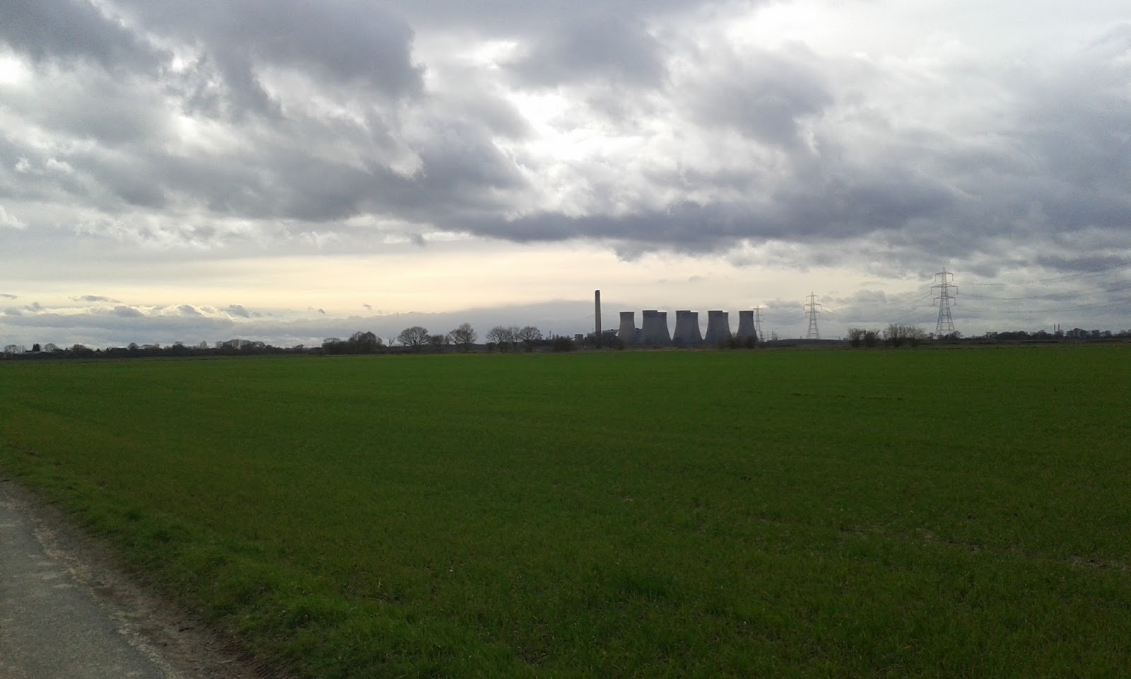
Heading now, feet refreshed and bellies refueled, toward the village of Topham and then on toward the crossing of the Aire and Calder canal, we passed a converted windmill before crossing the river Went. Shortly after we had to pass under a high voltage power line, where we noticed a very bad wind oscillation on the cables of the lower tier. The photo below is in fact just to remind me to report it to National Grid!
We were now approaching Pollington, and crossed the Aire and Calder canal. By now the rain had mostly stopped, and we were beginning to dry out. Bobs fear of having suffered a stroke proved unfounded when it was realised that he just couldnt feel one side of his face from the windchill, and I was still suffering the bizarre one dry/one wet hand, due to being constantly battered by the wind and rain on my left side.
From the Aire and Calder it was back to road walking, a mile or two, during which time we again had to find somewhere for an impromptu refreshment break, and we were climbing the bridge up and over the M62
I took the opportunity, which rarely presents itself, to do a spot of dad dancing on the bridge, much to the amusement of several passing drivers
So, we were now ready for another sock change break, and had planned this to be in the churchyard at Snaith Priory. But, Bob being Bob, the desire for porcelain plumbing led us into a nearby pub.
So we took the time to enjoy a cold drink (non alcoholic!) and relax for a while, whilst giving the old tootsies a fresh load of tape and padding. Bob enjoyed inspecting his blisters, which by now were quite a bumper crop, and decided that the weather was actually quite nice now, so we would pack away the waterproofs.
It was, however, still a bit chilly to do without the woolly hat!
From Snaith, there were just a half dozen miles to go! Our marker for the distance was to be Eggborough power station, which loomed on the horizon. From Snaith the road took us out over the river Aire into Carlton, where we realised a few hundred feet could be shaved off the distance by taking a side road, and then we struck out onto the long road section to Hirst Courtney and its many commercial greenhouses. By now our feet were starting to get a bit sore. My dodgy toe was intermittently giving me a lot of grief, its sharp and sudden intense pain making me wince, but was relieved for quite a while by any short rest stop, such as the one I took behind a tree just short of Temple Hirst!
By now we had adjusted the data fields indicated on the GPS units to show remaining distance. This proved to be a good moral boost. The weather was better, still windy but now on odd occasions even warm enough to remove the hat for a while!
But shortly after leaving Hirst Courtney to head on to Burn, the weather decided we'd had quite enough pleasant walking, and the rain started again. We held out for a while then stopped and put our waterproofs back on. The rain stopped about ten seconds later! But, it would prove to be intermittent from now on, so we kept on as was.
Reaching the level crossing at Burn shortly after a train had passed, I decided I needed to rest the toe for a little while. So as we started around the peritrack of the old RAF Burn airfield, we looked for a place to stop. A small mound of rubble suited this purpose, and we rested for a few minutes and shared a bottle of Lucozade. We were nearly there, over twenty miles done, and in great spirit. We were starting to tire, the legs beginning to ache, and the feet a bit sore, but remarkably better than usual for the distance, and in spite of the weather. The airfield was skirted with much discussion on the fields history. It was nice for me to be walking a familiar section but which Bob was new to.
Our route off of the airfield though did look somewhat tricky as we approached -
Luckily, this expanse of water was only a few inches deep, and we were soon around it and ambling up the side of the railway to the underpass below the A63 bypass, where we got our first glimpse of the Selby canal and the familiar route of our old stamping ground of the Selby Horseshoe. As we crossed Brayton bridge to gain the towpath, the GPS units indicated a trifling 1.5 mile remaining! I had already sent a text to my good lady requesting our taxi for 18:00 outside the Abbey! But, at this point for me personally, a more pressing priority seemed to be the possibility of having to repeat Bobs earlier actions beside the South Yorkshire Navigation! Talk turned to whether or not the Abbey would still be open to use the visitor facilities!
The familiar sight of the chemical works and the shops appeared, closely followed by the Selby Boat Center and its collection of vessels. The bridge ahead would lead us off the canal towpath and onto the direct road to the Abbey
With a mere quarter of a mile to go we started up the railway bridge and passed the official sign for the town. Our feet now realised we were nearly there and decided they had already finished, so began to complain of having to keep going! But it was such a short little distance to go, and even the temptation of the odours wafting from the Jinnah curry house didnt divert us
As it happened, the Abbey was closed. But the main gate was open so we completed the walk as we had started, some 11h earlier, by touching the stone.
We then, having come some 27.7 miles, settled onto one of the benches to await recovery by my wife, who was delayed by the level crossing and Network Rails amazing ability to schedule four trains across it at the same time. During our brief wait, we met a chap somewhat worse for a few bevvies, and seemingly undecided whether to be sad at some perceived sporting failure, or to continue singing joyous hymns, and as if it knew we were now sat, immobile, wet and cold, it began to absolutely piss it down again.
About ten minutes later, we were collected by my wife, with my son, and in my car, and driven home. A brew and a snack, and for me a change of clothes and a visit to the lavatory, and all that remained was for me to drive back to Doncaster, drop Bob off, collect my trainers and flask from his car, visit my mum, and drive back home to Selby for a nice hot bath. Stopping just the once in Eggborough to relieve the cramp in my leg!
27.7 miles, 11 hours. And now we have seen a few places we can shave a mile or two off. Bob has published the route as a Garmin Adventure for others to try, and were considering doing it again, but adding the York Lines route and taking it all the way to York Minster, after all, its only another 16 miles...